ISRO shares seven space-view pictures of Indian cities captured by Resourcesat-2A
Resourcesat-2A, the eighth remote sensing satellite of ISRO has successfully beamed back seven stunning images of Indian cities, which were published on the website of ISRO on Wednesday. The Indian Space Research Organization (ISRO) on Wednesday published a set fo seven eye-catching views of some Indian cities captured by the country’s seventh remote sensing satellite Resourcesat-2A.
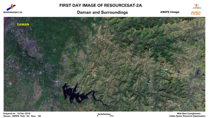
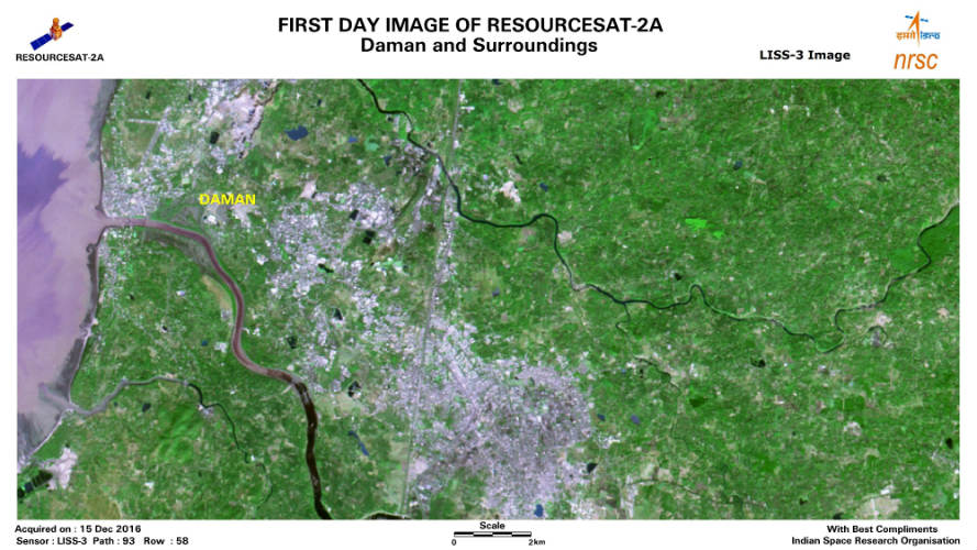
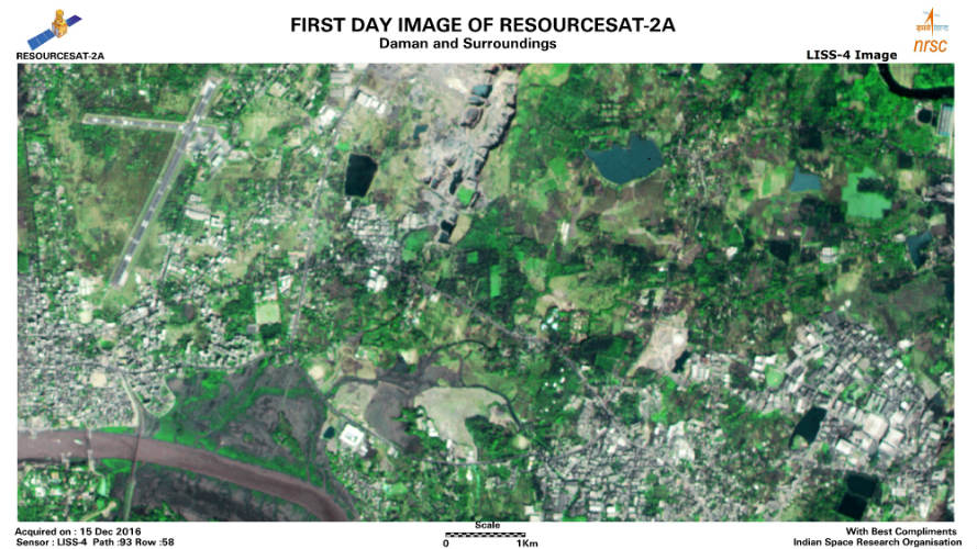
On Wednesday, 21st December, ISRO uploaded a series of seven pictures on its website alongside on its social media accounts. The pictures were clicked on 15th December by high resolution onboard cameras of the satellite. The spaceship of ISRO, RESOURCESAT-2A has two high resolutions on board cameras like LISS-3 and LISS-4 which are integrated with a spatial resolution of 5.8m and 23.5m. The satellite, weighing 1,235-kg is currently positioned in an 818km polar sun synchronous orbit.
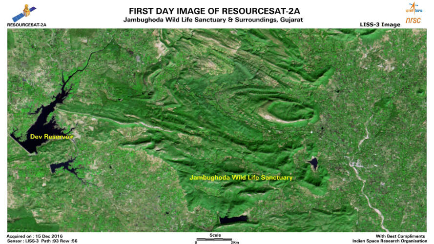
In the transmitted pictures, the spaceship has clicked the views of some Indian cities from the space, including Vadodara, Daman, wildlife sanctuary of Jambughoda, and some of the nearby areas in Gujarat. Along with the snaps of these places, some nearby reservoirs, lagoons, and human footprints are also noticeable on the images.
Along with three multispectral high-resolution cameras, Resourcesat-2A is also enriched with two strong and powerful storage sections with the storage capacity of 200 gigabits, which is intended for storing pictures clicked by its cameras, which the ground-based stations will access later.
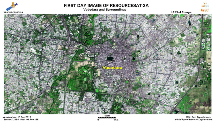
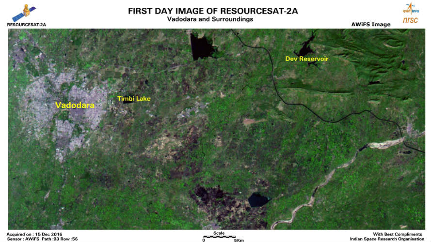
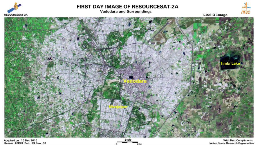
As mentioned above, resourcesat-2A is the seventh remote sensing satellite of ISRO, which is intended to monitor earth’s resources. The Satellite was launched on 7th December 2016 with the PSLV-36 rocket from Satish Dhawan Space Centre in Sriharikota. With 1,235-kg weight, the satellite is placed at 817 km polar Sun Synchronous Orbit (SSO). PSLV-36 is intended to monitor Earth’s resources from the space. Apart from resources monitoring, the satellite will also enhance the remote sensing data services to global users. The PSLV-36 RESOURCESAT-2A bears 3 multispectral onboard cameras which are helping the space probe to catch the precise and clear images of Earth from space.