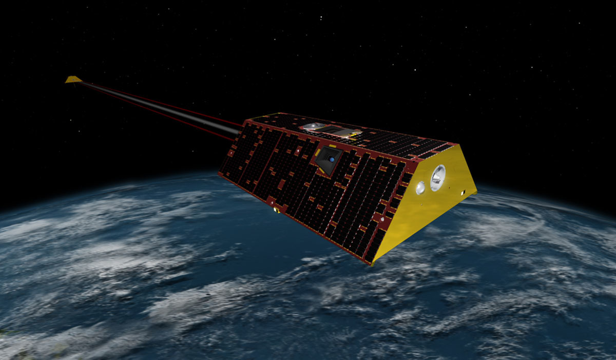
NASA’s GRACE-FO twin satellites will soon register gravitational pull, flow of water and predict floods & earthquakes
SpaceX will soon launch the NASA GRACE-FO satellite along with Iridium NEXT satellite from the Vandenberg Air Force Base in California on Tuesday at 12:47 p.m. PDT or 19:47 UTC. GRACE stands for Gravity Recovery and Climate Experiment and it is a pair of two satellites that will work in tandem. The twin satellite mission will soon replace the existing & retired twin GRACE mission that has been in operation for over 16 years. The Twin GRACE-FO satellites will register Earth’s gravitational field with exquisite sensitivity.
According to NASA’ Jet Propulsion Laboratory (JPL), the twin satellite will rely on Earth’s gravitational field. It means that their speed will change with respect to the gravitational field exerted by the Earth that varies with total mass. To put things into context, regions with higher mass i.e. where there are ice sheets or water or mountain have stronger gravitational field while the region where the mass isn’t much, the field is weaker. This will help both the satellites to create a gravitational map of the region by calculating the difference in the distance between these two satellites flying in tandem whose magnitude could be less than the width of the human hair.
According to Felix Landerer who is a geophysicist at the NASA’ JPL, the gravity map prepared by these twin satellites will show lumpiness that varies from place to place and even from one month to another. He further explained that when the snow accumulates on mountains, the mass increases. During spring, the ice melts and then in summer, the soil dries up. This creates a shift of water mass from region to region that alters the gravity field of the particular region.
NASA will collect the data from these twin satellites in order to detect the flow of water which will be used in many ways. Take the old GRACE satellites for instance which calculated the thickness of ice sheet in Greenland. These satellites saw more than 4,000 gigatons of ice melting from Greenland. The region is massive in terms of mass and thus exerts its own gravitational pull on water. This means Greenland actually pulls the water towards itself but as soon as the ice begins to melt, the force on the surrounding water decreases. Therefore, ice melting in Greenland wouldn’t affect the sea level of the surrounding area as much as the seal level of distant places.
Also, the satellites will help pick up precursors to advancing earthquakes. It was found out that before the disastrous Tohoku earthquake followed by the tsunami struck, GRACE captured an anomaly in the redistribution of mass which started few months before the incident. The upcoming GRACE-FO satellites will help detect floods and earthquakes much before it hits the coast and causes the life of thousands and millions of people living in the affected area. SpaceX will broadcast the launch of GRACE-FO and Iridium-6 mission live on its website.