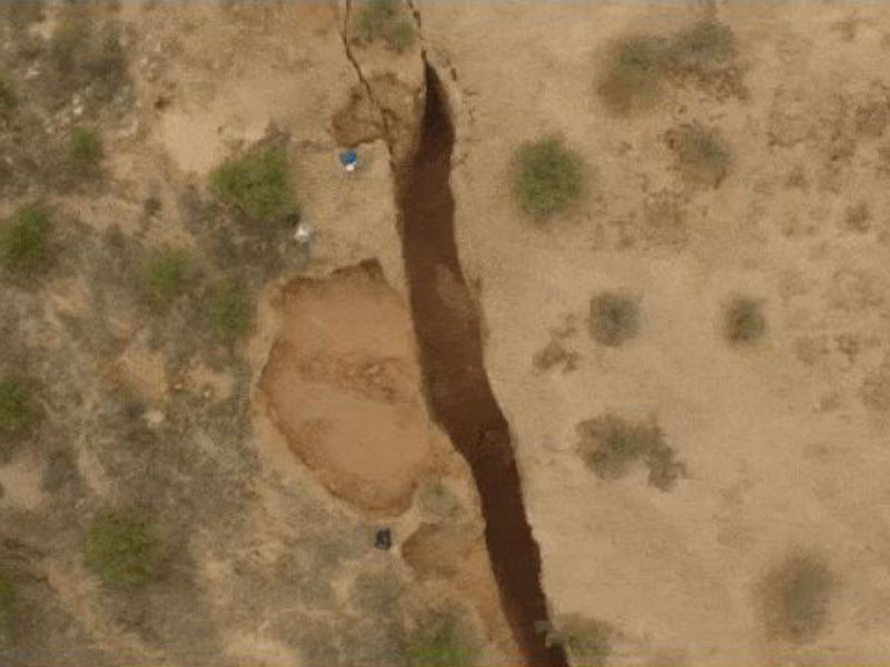
The ‘Arizona Geological Survey’, which was initiated by the Arizona Legislature for monitoring and detailing the barren desert Arizona’s geology, has found a 3.2-km long crack on the surface of the desert. The withdrawal of groundwater for agricultural applications is believed to be the primary cause of this 3-km long fracture. Some recent drones, which took wings over the split, reveal that the crack has been spreading out, however, researchers said, “There is nothing to worry about the crack.” As per the fresh reports of Arizona Geological Survey, the fissure is spreading out both in length and breadth in Pinal County towards the southeast of Phoenix.
A team of Geologists accompanied by the officials of the Arizona Geological Survey (AZGS) first spotted the fracture in Arizona in 2014. The researchers, while examining Google Earth images, stumbled upon the crack and now, after 3 years, the drone experiments revealed about the growth of the cracks towards the southeast of Phoenix. By making some earlier examinations this year, the found out the 3.2-km wide rupture in the barren land of Arizona.
According to the statement of a local newspaper, the fissure is situated in the Tator Hills region of southern Pinal County, 20 km (13 miles) south of Arizona City. Though till now, the crack hasn’t shown any threat to nearby areas, but it could pose a menace to the vehicles driving all the way to that particular location. It may also grasp the farm animals or humans standing nearby the brittle edge.
Researchers, for conducting the experiments, used the GPS mapping together with an aerial drone. The drone took flight over the crack to monitor and frame its length, while scientists recorded the data over the GPS network. However, after closing up the experiment, they were surprised to discover that the crack is much longer than its previously expected to be. Moreover, they also found the crack to be increasing in size, over the years.
As expected by the geologists, the crack will be widened in the coming years and will be stretched out up to 3 meters (10 feet). They also predict that the widest part of cracks will be stretched up to 10 feet and later will fall down into the void. The fissure is estimated to throw 9 meters (30 feet) deep in some locations. In contrast to the previous year examination report, the Arizona crack, this year has opened up a whole new section and is continuing to broaden over the time.
As per the statement, given by the lead geologist Joseph Cook at Live Science, “When I arrived at the location to map the Arizona fissure, I realized the crack was broadened than what was perceptible in the Google imagery, back in 2014. In comparison to the previous inspection, the crack has spread out nearly 2 miles long in total.”
Though it is not confirmed what has caused the crack to widen, but geologists expect heavy rains between 2014 and 2016 to be the primary cause of the deep fissure.
