


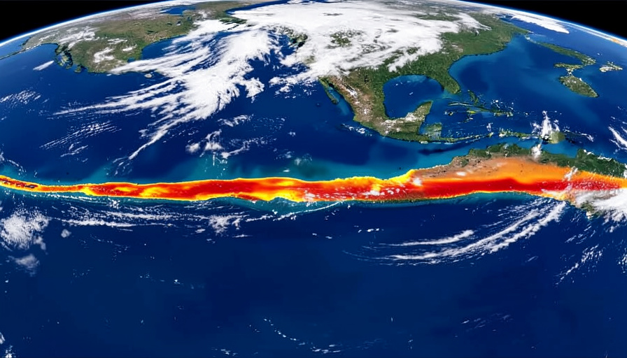
Every few years, a stretch of the tropical Pacific Ocean warms up by a degree or two, and the whole planet feels it. Fisheries off South America collapse for a season, Australia braces for drought, the Indian monsoon wavers, and the year often ends up among the hottest on record. The cause of all this is a climate pattern with a deceptively gentle name: El Nino.
El Nino gets blamed for a lot of strange weather, often loosely, so it is worth knowing what it actually is. At its core it is a shift in how the ocean and atmosphere of the tropical Pacific interact, one that ripples outward to influence weather across much of the world. Here is how a warm patch of sea manages to reach so far.
Bottom line first
El Nino is the warm phase of a natural climate cycle in the tropical Pacific called the El Nino-Southern Oscillation, or ENSO. Normally, trade winds push warm surface water toward the western Pacific. During El Nino those winds weaken, and the warm water slides back eastward toward South America. Because storms follow the warm water, this rearranges rainfall and temperature patterns around the globe. It happens irregularly every few years and lasts around nine to twelve months. Its cool opposite is called La Nina.
What El Nino actually is
El Nino is one half of a seesaw. Scientists call the whole cycle the El Nino-Southern Oscillation, and it swings between a warm phase, El Nino, and a cool phase, La Nina, with neutral spells in between. It is a coupling of the ocean and the atmosphere, meaning the sea temperature and the winds above it push on each other and change together.
The name comes from Peruvian fishermen, who noticed that a warm current sometimes appeared off their coast around Christmas and named it El Nino, a reference to the Christ child. As the US National Oceanic and Atmospheric Administration describes, most scientists now use ENSO and El Nino to talk about the same broad phenomenon in the tropical Pacific. For more from the natural world, browse SciExaminer’s Environment section.
How the Pacific usually behaves
To understand El Nino, start with a normal year. Along the equator, the trade winds blow steadily from east to west, from South America toward Asia and Australia. These winds drag the warm surface water of the Pacific along with them, piling it up in the west into a huge reservoir of warm water known as the warm pool.
As that warm water is pushed away from South America, cold water rises from the deep to replace it along the eastern edge, a process called upwelling. That cold, nutrient-rich water feeds one of the most productive fisheries on Earth. So the default state of the Pacific is warm and stormy in the west, cool and fish-filled in the east. El Nino turns that arrangement on its head.
What changes during an El Nino
An El Nino begins when the trade winds falter. For reasons that are still partly a puzzle, the east-to-west winds weaken, and sometimes even reverse. Without the winds holding it in the west, the warm pool of water begins to slosh back eastward across the Pacific toward South America.

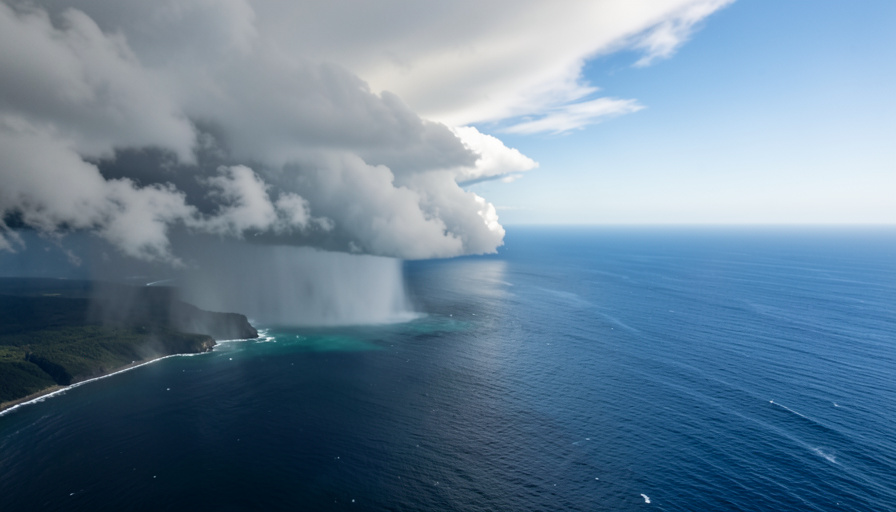
As the warm water shifts east, so does the weather that comes with it. Sea level in the eastern Pacific can rise by as much as a foot as the warm water arrives, and the cold upwelling off South America is choked off, warming the sea and starving the fisheries. Crucially, thunderstorms tend to form over the warmest water, so the tropical rain belt migrates eastward too. That single change, warm water and its storms moving across the Pacific, is what sends effects rippling around the world.
How it reshapes weather worldwide
Because El Nino relocates the engine of tropical rainfall, it tips the odds toward wetter conditions in some places and drier ones in others, often thousands of miles away. It does not dictate any single day’s weather, but it loads the dice for a whole season.
According to the World Meteorological Organization, El Nino raises the risk of drought across Indonesia, Australia, and parts of southern Asia, while pushing wetter weather toward the southern United States and parts of South America. The UK Met Office adds that it tends to weaken the Indian monsoon, suppress Atlantic hurricanes by increasing wind shear, and push global average temperatures upward, which is why El Nino years so often rank among the hottest on record. A warm patch of ocean, in other words, ends up touching harvests, water supplies, and storm seasons on several continents.
La Nina, and how scientists track it
El Nino has a mirror image. When the trade winds instead grow stronger than usual, the eastern Pacific turns unusually cold, and that cool phase is called La Nina. It generally pushes weather in the opposite direction from El Nino, so the two are best understood as swings of the same pendulum rather than separate events.
To measure where the pendulum sits, scientists watch sea-surface temperatures in a stretch of the central Pacific called the Nino 3.4 region and track a running average known as the Oceanic Nino Index. Conditions are formally called an El Nino when that index stays at least 0.5 degrees Celsius above normal for several overlapping three-month periods. The cycle is irregular, recurring roughly every two to seven years and typically lasting nine to twelve months, which is why forecasters watch the Pacific so closely for the earliest signs of a shift.
Main takeaways
- El Nino is the warm phase of the El Nino-Southern Oscillation in the tropical Pacific.
- It starts when the trade winds weaken and warm water shifts east toward South America.
- Storms follow the warm water, so tropical rainfall patterns move and global weather shifts.
- Typical effects include drought in Australia and Indonesia and a wetter southern United States.
- Its cool opposite is La Nina, and scientists track both using Pacific sea-surface temperatures.
Frequently asked questions
What is El Nino in simple terms?
El Nino is a natural climate pattern in which a large part of the tropical Pacific Ocean becomes warmer than usual. It is the warm phase of a cycle called ENSO, and it shifts weather patterns around the world, bringing drought to some regions and heavier rain to others.
What causes El Nino?
It begins when the trade winds that normally blow warm water toward the western Pacific weaken. The warm water then spreads back eastward toward South America, warming the eastern Pacific and moving the tropical rain belt with it, which changes weather across the globe.
How is El Nino different from La Nina?
They are opposite phases of the same cycle. El Nino is the warm phase, with weakened trade winds and warm water in the eastern Pacific. La Nina is the cool phase, with stronger trade winds and unusually cold eastern Pacific water, and it generally pushes weather the other way.
How often does El Nino happen and how long does it last?
El Nino occurs irregularly, roughly every two to seven years, and a typical event lasts about nine to twelve months. Because the timing is not fixed, scientists monitor Pacific sea-surface temperatures continuously to spot one developing.
Does El Nino make the world hotter?
It nudges global average temperatures upward for a time by releasing heat from the ocean into the atmosphere. That is why El Nino years often appear among the warmest on record, though the pattern is a temporary swing layered on top of longer-term warming.
What this means
El Nino is a reminder that the ocean and the atmosphere are a single connected system, and that a change in one corner of it can be felt everywhere. A shift in the Pacific trade winds, invisible to almost everyone, reshuffles rainfall and temperature across continents and helps decide whether farmers face drought or flood a hemisphere away. Understanding the pattern is why forecasters can now give months of warning when an El Nino is brewing, turning what once looked like random bad luck into something we can prepare for. For more on the systems that shape our planet, the Science section digs deeper.